Background
Lambeth is one of 14 local authorities which make up Inner London.
The statutory development plan for the borough sets out planning policies for Lambeth to guide growth in housing and jobs, infrastructure delivery, place-shaping and the quality of the built environment.
To support the plan, a series of local area maps are needed to help illustrate the proposed policies.
Brief
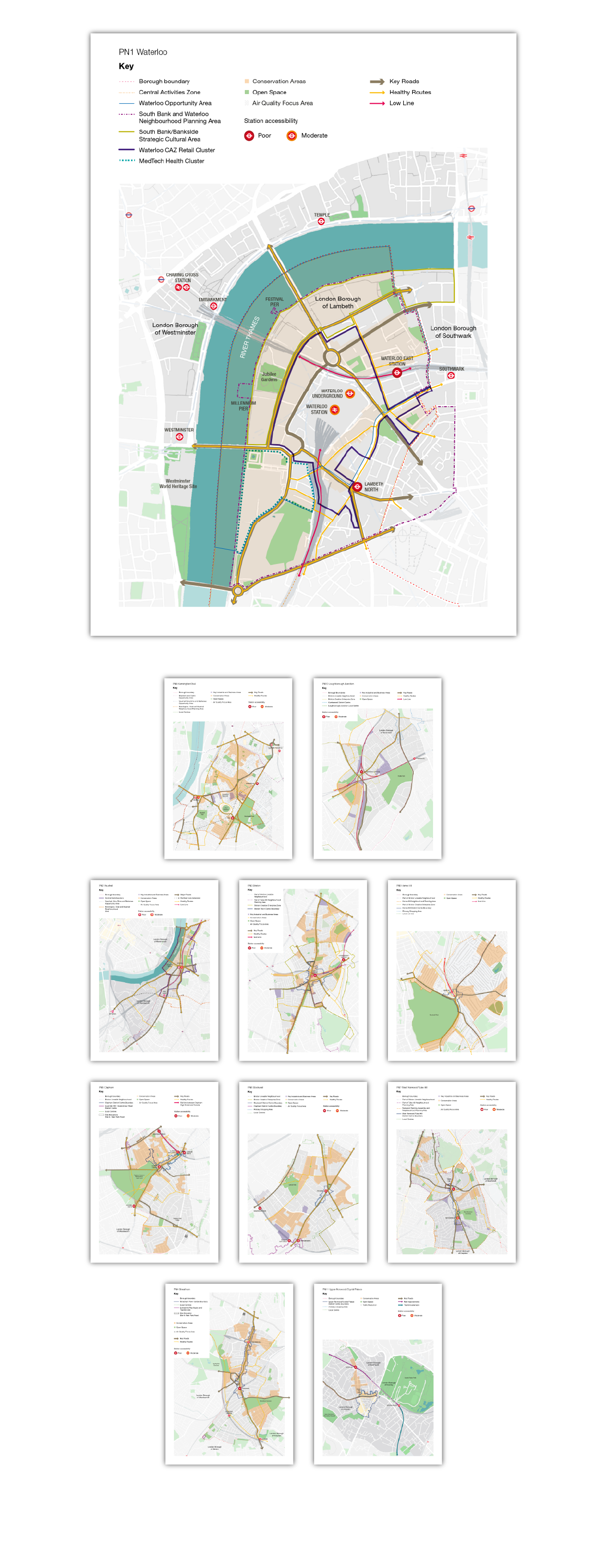
Draw up a set of 22 maps, showing both large and small-scale views of key local areas of Lambeth, for the Places and Neighbourhoods chapter of the new Local Plan.
The base map should show geographic features, existing buildings/infrastructure, railways and roads, with approximately 15 editable overlays showing administrative boundaries, zones, areas, key transport routes, key locations/hubs and proposed/new buildings/infrastructure, and up to three new public realm areas.
Solution
To produce example large and small-scale maps for approval, I collated data from multiple sources, including Cadmapper, London conservation areas, Googlemaps, Lambeth Air Quality Action Plan, Lambeth Local Implementation Plans, Lambeth Transport Strategy, OS and TfL.
The main challenge was differentiating between layers in those areas where many different features intersected, whilst retaining consistency across all 22 maps.
Once the style was agreed, I drew up the remaining maps, with the design, approvals process and artwork taking approximately two months.